Walk any stretch of Central Avenue between Bethany Home Road and Glendale Avenue on an October morning and you will see the same choreography you saw the October before. Runners in the dirt lane, a leashed shepherd stopping at the same olive tree, two neighbors trading news in the shade of a hundred-year-old canopy. What looks like a footpath is something rarer. The Murphy Bridle Path is the only linear park in Arizona maintained by a municipal parks department, a designation the North Central Phoenix Homeowners Association uses to explain why residents keep raising money for individual ash trees.
That distinction matters more than it sounds. A trail is a route. A linear park is a piece of civic infrastructure with a ledger, a preservation status, and a maintenance calendar. Once you see it that way, the fall rituals along Central start to make sense.
The Ledger Behind The Shade
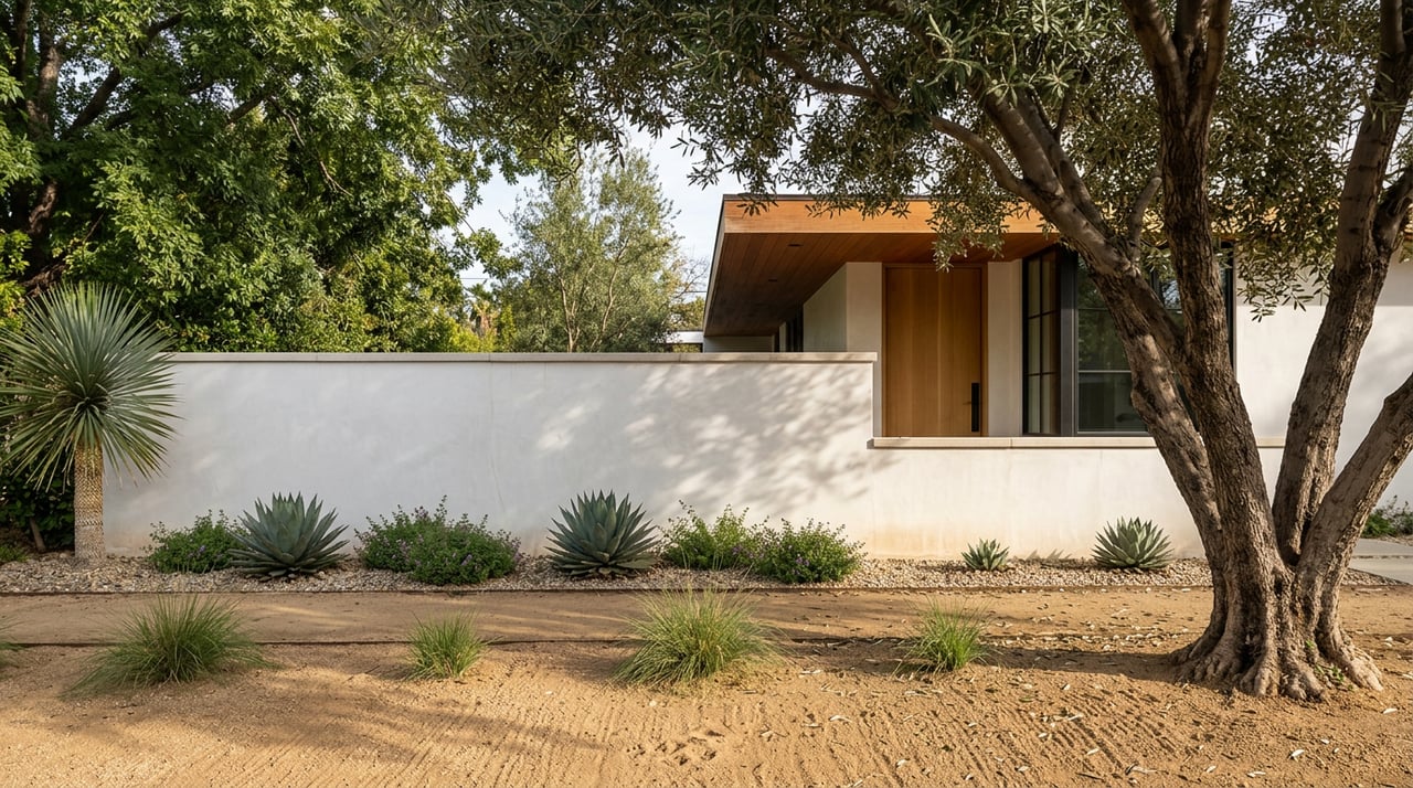
The canopy over the path is not accidental. Valley developer William J. Murphy planted ash trees along both sides of Central Avenue from 1895 to 1906, then layered olive trees on top of that from 1906 to 1915, according to the historic-district record kept at Historic Phoenix Districts. The point was to make the northern extension of Central attractive to buyers who had never lived in a desert. It worked, and it kept working, which is why the streetscape carries a listing on both the State and National Register of Historic Places today.
The path itself came later. The earliest reference the city's historic preservation office could find dates the bridle path to a 1948 dedication by the Arizona Horse Lovers Club, the same group responsible for the iron horse-head gateway at Bethany Home and Central. The wrought gateway is still there. The horses are mostly not, though the path retains its equestrian-legal status.
One detail residents rarely repeat, but should: in the 1960s the city swapped the aging ash trees for pines. The neighborhood revolted. By the 1970s the pines were out and ash trees were back. That two-decade correction is a useful frame for anyone new to the area who assumes the canopy manages itself.
What The Path Actually Is, In Numbers
A 2.6 to 2.7-mile dirt lane running one-way along the east side of Central Avenue, from Bethany Home Road north to the Arizona Canal, with about 78 feet of elevation change across the full out-and-back. Free, unpermitted, dog-legal on leash, horse-legal.
Those numbers come from the AllTrails and Great Runs entries for the path. The elevation figure is worth pausing on. Seventy-eight feet across five-plus miles is functionally flat, which is why the path is used by an unusual cross-section of residents. Stroller pushers, older walkers who have stopped hiking Piestewa, cyclists cutting across the corridor, high school runners from the Brophy and Xavier clusters. In a city where most cardio happens on graded desert singletrack, a flat, shaded, in-neighborhood loop is the reason so many households on the 7's never bought a treadmill.
Where To Enter, Where To Stop
The path does not have a formal trailhead. It has entry points, and the entry point you pick shapes the walk.
- South end, Bethany Home and Central. The iron horse-head gateway. Street parking on the residential side streets is the local move. The stretch immediately north of here has some of the densest ash canopy.
- North Phoenix Baptist Church lot at Central and Bethany Home. Great Runs flags this as the practical parking option for anyone driving in from outside the neighborhood. Ask permission during service hours.
- Mid-path, Glendale Avenue crossing. A common turnaround for the two-mile crowd. The Whitfill Nursery is nearby on Glendale, which matters if you are one of the households the NCPHA has been nudging to replace a private-property olive.
- North terminus, Arizona Canal. The path ends at the canal, and the canal keeps going. This is the connection most residents underuse. The Arizona Canal Trail runs roughly 36 miles through the metro and links, eventually, to the multi-use paths in Scottsdale and Paradise Valley.
- Royal Palm Park, one block off the path. Twenty-nine acres of green with a shaded playground, useful if the walk is doubling as a kid-management strategy.
The coffee stop that residents fold into the routine is Lux Central at 4402 N. Central Avenue, a block off the path and open early. It is a full kitchen and bar as well, which is why it doubles as a Friday evening endpoint rather than only a morning one.
The Cool-Months Rhythm
The Phoenix climate does most of the scheduling on the path. From late October through April the shade stops being a bonus and becomes optional, which changes the hours residents actually use it. A rough shape of the week:
Mornings, 6:30 to 9:00
The dog-walker and runner window. Traffic on Central is present but the path sits far enough off the roadway that conversation is possible. Ash leaves start turning by mid-November and drop through January, which is when the dirt surface visibly changes color. This is the window locals use to bring out-of-town family, because it is the version of the path that photographs.
Late afternoons, 4:00 to sunset
Strollers, older walkers, the after-school student runners from the Catholic prep cluster. The olive trees on the private lots east and west of the path carry fruit through much of this stretch. If you have not walked past a bearing olive on a warm January afternoon, the smell is the neighborhood in a sentence.
Weekends
The path fills. It does not overfill. Compared to Piestewa Peak or Camelback, where the AllTrails reviews routinely warn about parking and crowding, the Bridle Path is self-regulating because it is linear. Density spreads across five miles instead of stacking at a summit.
What Residents Actually Own
This is the part that catches new arrivals off guard. The city owns the land on either side of Central up to the private property lines. The NCPHA has spent more than forty years advocating for that public right-of-way, which is why the association is currently running a beautification campaign asking residents to fund replacement ash trees at $350 each through Phoenix Parks and Recreation. Whitfill Nursery on Glendale Avenue offers a discount to Central Avenue property owners replacing non-fruiting olive trees on their private lots. Both efforts exist because the city's parks budget is not, on its own, sufficient to maintain the canopy at the density residents expect.
There is a lesson in that. The shade you walk under most mornings is maintained by a mix of municipal budget, individual homeowner spending, and a homeowners association that has been paying attention for four decades. It is a private-public collaboration disguised as scenery.
The signage rules are the other piece worth knowing if you own property near the path. The NCPHA is explicit that no business signs, including real estate signs, are permitted in the city-owned strip along Central. Signs obstruct sightlines and pedestrian paths and are removed. For residents preparing a home for sale on any of the streets feeding into the path, this changes the marketing playbook. The showing itself does the work, and the walk from the car to the front door is often the first impression that matters.
A Neighborhood That Reads Itself
The Bridle Path is the rare piece of Phoenix that rewards the same walk repeated over years. The trees change slowly. The gateway does not move. The households along Central have often been there long enough to know which ash tree came in during the 1970s replant and which came in last spring. If you have moved into the corridor recently, the fastest way to understand what you bought is to walk the path in three different seasons and pay attention to what is being maintained, by whom, and at what expense.
The homes that line this corridor carry a stewardship layer most Phoenix properties do not. Selling one, or buying one, is a different conversation than a transaction in a newer submarket. When you are ready for that conversation, Luxe Client Group is available for a confidential consultation.